Check out these Skywarn images:
WX4RNK-first-RADAR
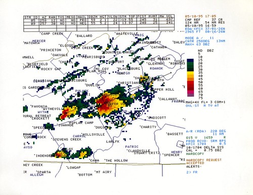
Image by n3pb
The first activation of Blacksburg SKYWARN was about 1PM on 10 May 1995. This is a scan of a printout from the (relatively new) NEXRAD WSR-88D RADAR showing one of the first storms we tracked. There was only one display for the RADAR (the PUP) in the office. The NWS forecasters would print out hard copy of interesting storms for SKYWARN. In later years, there was a video monitor in the SKYWARN station that displayed the right side screen from the PUP. Today, everyone has access to the current RADAR data.
The color printing technology was a Tektronix "solid ink" thermal printer. In a nutshell, it would melt colored wax (kind of like a crayon) and deposit the ink on the page — very high quality for its day.
CRW_8892: Melody and Jim Hand Out Skywarn Awards

Image by ac4lt
Slide illustrating the limitations of weather radar & why spotters are needed. #skywarn
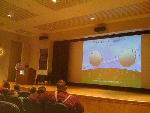
Image by clubjuggler
Posted by twitter.com/clubjuggler


Leave a Reply
Want to join the discussion?Feel free to contribute!